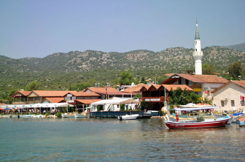
Uçagiz/The Kekova Roads 36°11.36′N, 29°51.11′E
Uçagiz Liman is a nearly landlocked lagoon, always calm with excellent shelter. It is accessed through a rocky channel which requires navigational care and vigilance. Being part of The Kekova Roads, its vicinity is spotted with Lycian settlements now submerged under calm, translucent waters.
In contrast to the rest of The Kekova Roads, the water here is not clear due to a very muddy bottom. It has reasonable holding, although some plough-type anchors will dig a furrow through it unless given plenty of chain. It is not unusual to need three or four attempts before the anchor holds. The best holding appears to be in the western arm of the inlet, to the west of Uçagiz town, where the depths are 6-7 metres. One can also anchor in the eastern arm, although there is a slight chop here from the prevailing SW winds blowing in through the entrance.
A T-jetty can accommodate around 20 yachts. There are a just few laid moorings, so it may be necessary to use your anchor. Depths off the jetty are around 4-5 metres. There are water and electricity points. There is a second jetty to the west, but this is for gulets only.
There is a good selection of restaurants in Uçagiz town.
To the east, accessible by a rocky path is the necropolis of an ancient Lycian town, numerous Lycian sarcophagi and a small acropolis on a rocky headland with excellent views of The Kekova Roads.
Facilities
- Several restaurants in Uçagiz town
- Mooring/anchoring in various bays and coves
- Jetty in Uçagiz town for approximately 20 yachts
- Water and paid electricity is available
- Limited provisions
- See an important Navigation note on The Kekova Roads page


